London Map
Interactive Sightseeing for Tourists!
Click on the INFO field for help.
PRINT AREA
MAP
Interactive Tourist Map for London
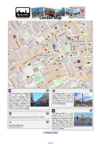
London offers a large choice of top attractions for tourists. The interactive map from city-walks helps you to plan your free sightseeing tour:
- To discover your personal highlights just click on the symbols in the map:
 £1 M1
£1 M1 
 ...
... - For the search for streets, squares, POIs and attractions use the text box next to
 and choose from the suggestions.
 - Choose your preferable display style at the layers symbol
 . You may select, for example, the satellite view, a hybrid style or a version with public transportation.
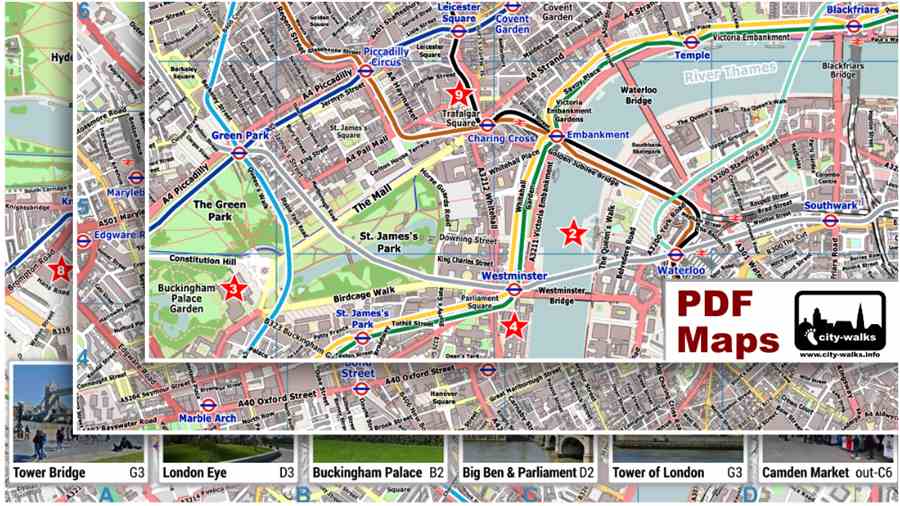
Printable City Map Travel Guide
But the interactive tourist map is not only suitable to explore London online. With a special printing format it is very easy to create your personal free printout of a city map travel guide for your sightseeing tour. By clicking on ![]() the attraction from the INFO Box will be attached below the map. If you hover with the mouse over the printer symbol
the attraction from the INFO Box will be attached below the map. If you hover with the mouse over the printer symbol ![]() and it is not possible to print the whole area, you will see a transparent box which shows the printable area on the map. The printout is built up by the map section of London and the below attached info boxes. With a click on
and it is not possible to print the whole area, you will see a transparent box which shows the printable area on the map. The printout is built up by the map section of London and the below attached info boxes. With a click on ![]() you can simple remove an unwanted info box at any time.
you can simple remove an unwanted info box at any time.